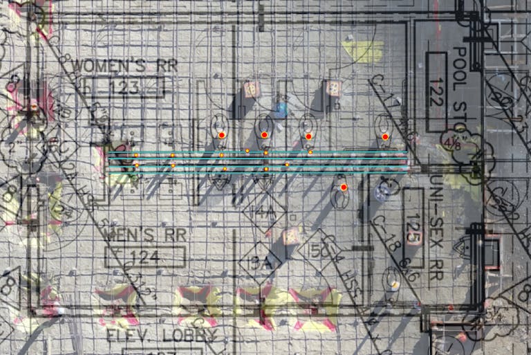
What began several years ago as an innovative method for capturing aerial progress of projects by drone has evolved at KPRS into a full VDC program—complete with the use of Site Scan for ArcGIS analytics platform, a fleet of drones and a team of licensed pilots. As KPRS industrial projects have become larger and more complex, integrating drone technology for added accuracy, quality control and risk mitigation is essential to each project's success.
The exciting part of Site Scan is that it allows the construction site to come alive digitally, creating an augmented reality that compares the real-life progress side-by-side with the intention of the design drawings. Adding this layer of oversight helps to keep projects on budget and on schedule. It reveals inconsistencies early-on that can be changed in CAD drawings instead of facing a cost increase to fix an error. It also allows for accurately measuring the quantity of dirt or other raw materials needed for the project, providing a more precise calculation.
“The greatest benefit for our teams is the accurate measurement of grade, elevation and predicting earthwork quantities using the “cut-fill analysis” tool based on the 3D image created. Using drone technology also allows us to better understand clash-detection with existing utilities. It helps us to finalize our constructability review and further confirm dimensions,” said Rick Espinoza, Division Manager of the Deliver Group.


